Aerial & Ground Imaging
Professional photos, videos, 360° virtual tours for industries, real estate, marketing and more.
MjøsDrone
Engineering & Innovation in Aerial Imaging
Driven by a passion for technology and engineering, MjøsDrone delivers state‑of‑the‑art drone imaging, surveys, and inspection solutions across Norway. We transform raw aerial data into actionable insights.
Learn More About UsSpecialized Aerial Services
Imaging & Visuals
High‑resolution photos, videos, and 360° panoramas that capture detailed visuals from multiple perspectives for diverse applications.
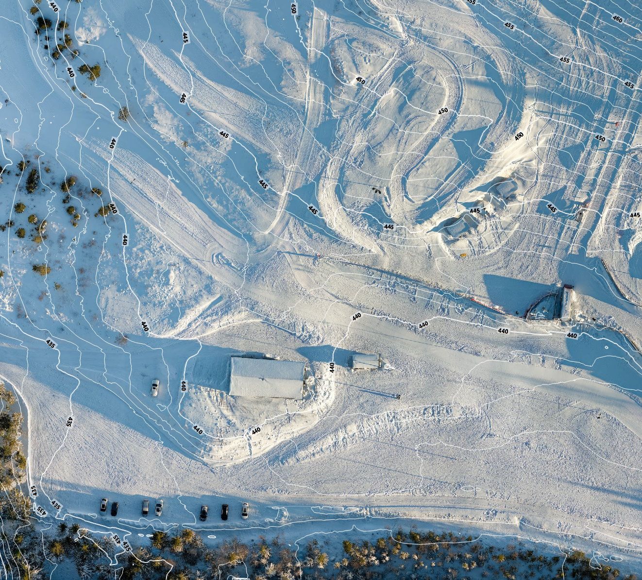
Mapping & Surveys
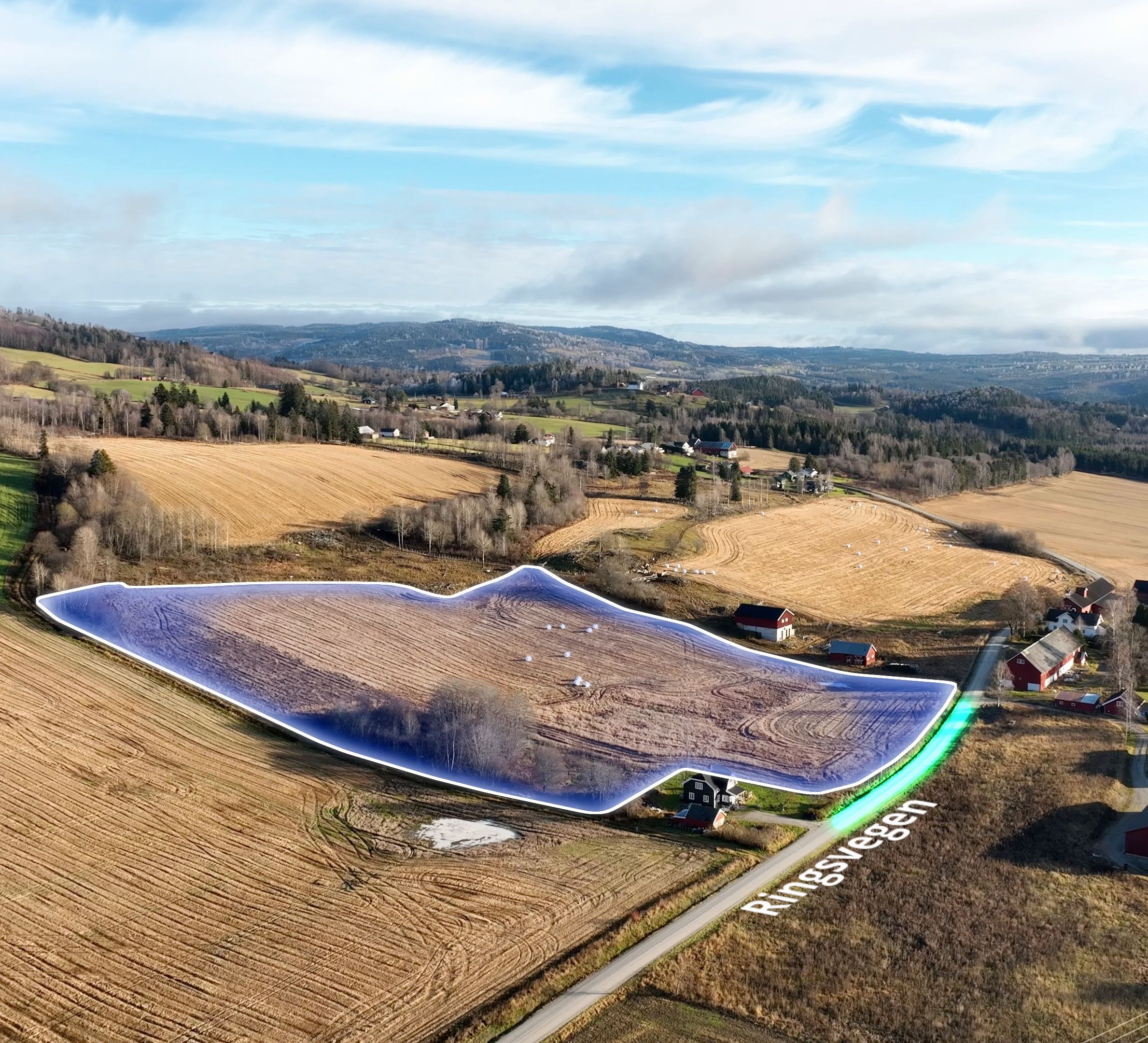
Accurate 2D orthomosaics maps, 3D terrain models and volume calculations for detailed site assessments, terrain visualization, and project planning.

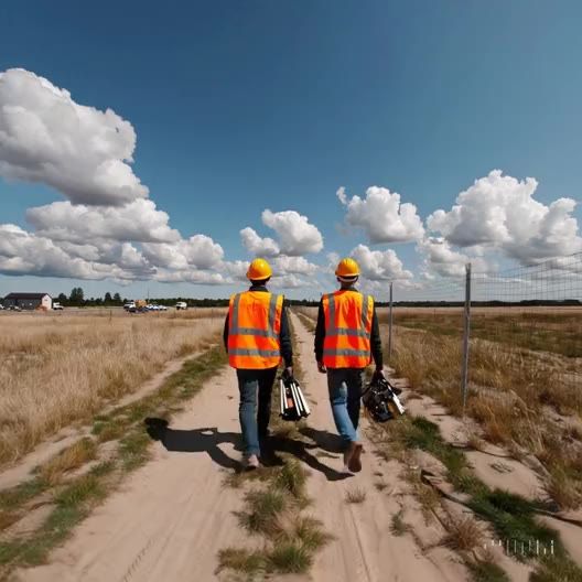
Inspections
Safe and comprehensive aerial inspections for critical infrastructure—bridges, towers, etc.— and buildings enable early issue detection and maintenance.
Visual Effects
Combine real‑world footage with motion graphics and 3D models to deliver visually enhanced narratives for construction and marketing.
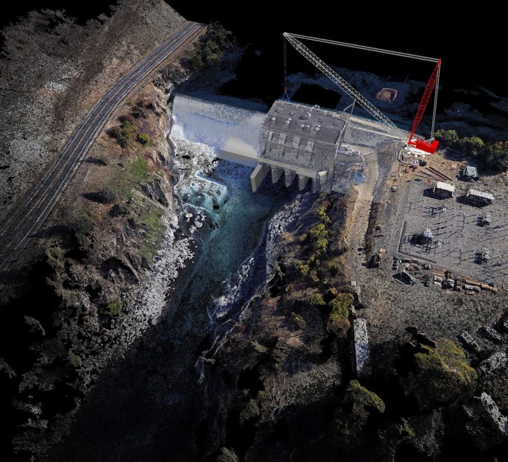
Photogrammetry
Photorealistic 3D models and digital twins created by capturing and processing high-definition aerial imagery.
Web Portal
Access, manage, and share all your mapping and imaging data through our intuitive, secure online platform.
MULTI-SECTOR SPECIALISTS
Industries we service
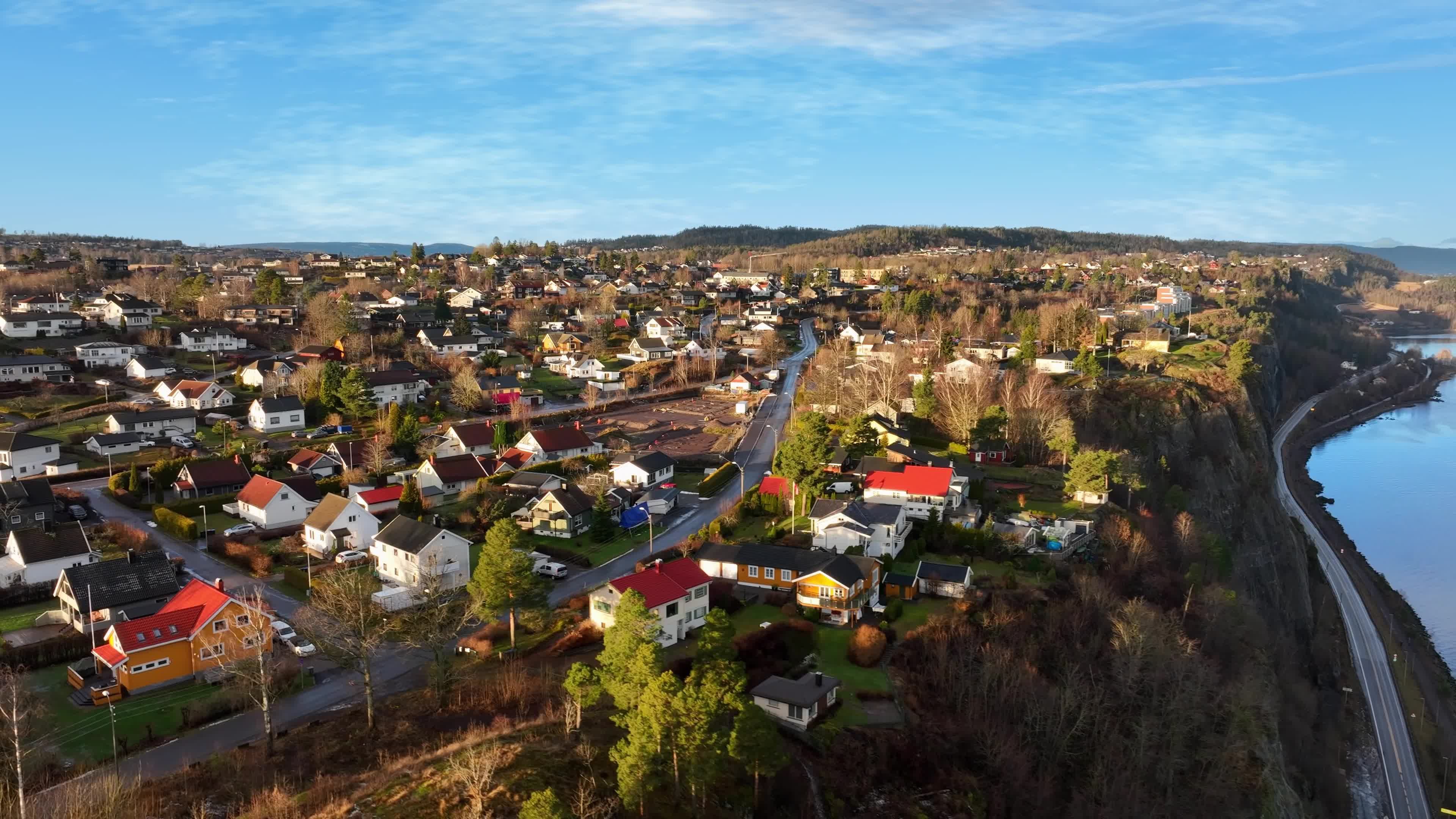
Keeping track of a construction project’s progress is critical to ensure that project timelines remain on schedule. MjøsDrone offers high-resolution aerial film and photography, orthomosaic maps, and 3D site models that provide an accurate representation of your construction sites.
Frequent, up-to-date visuals facilitate clear stakeholder communication, and yield technical insights effective in measuring progress and identifying potential deviations early throughout all stages of construction.
Beyond project monitoring, high-quality photography, film, and 360° virtual tours enable companies to showcase their projects with memorable visuals for investor reports, marketing material, and highlighting achievements.
Our customer portal ensures seamless access to all visual data, enhancing internal reporting, planning, and external presentations.
MjøsDrone helps industrial and logistics firms document, market, and manage their facilities with thorough aerial and ground-based imaging. High-resolution photography and 360° virtual tours provide a marketing asset in showcasing warehouses, distribution hubs, and manufacturing sites to customers and stakeholders.
Detailed orthomosaic maps and 3D models support site planning, stockpile measurement, and logistics flow optimization.
Regular inspections of roofs, infrastructure, and outdoor storage areas reduce risks and prevent costly downtime.
Our customer portal ensures seamless access to all visual data, enhancing internal reporting, planning, and external presentations.
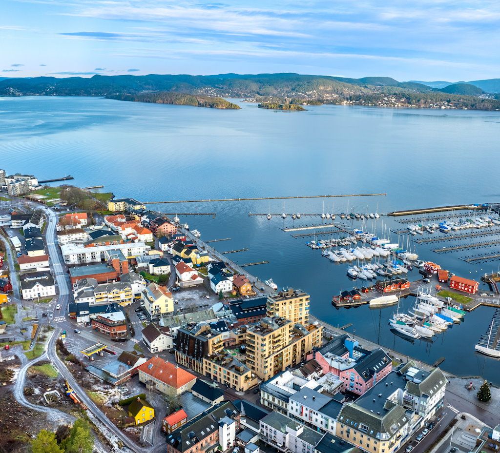
For commercial and high-value properties, high-quality visuals mean higher sale prices and faster turnaround. Listings featuring aerial images enjoy higher final sale prices than those without, making drone photography a cost-effective investment.
MjøsDrone captures properties from multiple perspectives using both traditional ground-based photography and aerial imaging, emphasizing key selling points such as lot size, landscaping, and neighborhood appeal. Our 360° virtual tours engage buyers at a distance while reducing unnecessary viewings.
Additionally, our roof and facade inspections provide sellers with upfront insights, preventing costly last-minute renegotiations.
Our customer portal ensures seamless access to all visual data, enhancing internal reporting, planning, and external presentations.
MjøsDrone supports energy companies with wind turbine inspections, overhead powerline surveys, solar panel inspections, and 360° panoramic images of sites. Our drone-based surveys enables rapid, non-invasive assessments over large areas of inaccessible land or difficult-to-access assets.
High-resolution imagery and thermal scans help identify maintenance needs early, extending asset lifespan and preventing failures before they become critical.
Topographical orthomosaic maps or 3D models provide an invaluable tool for managing vegetation encroachment and corridor planning.
The benefits of using drones to capture data in the energy and renewables sector are well-documented. By replacing risky at-height work and costly scaffolding with UAV surveys, energy companies benefit from significant cost-savings, reduced downtime, and greatly diminished safety risks.
Our customer portal ensures seamless access to all visual data, enhancing internal reporting, planning, and external presentations.
Telecom infrastructure maintenance is expensive, and traditional tower inspections require specialized personnel and costly equipment. MjøsDrone offers a faster, safer, and cost-effective alternative with drone-based inspections and surveys.
Our high-resolution imaging solution can detect corrosion, degraded or non-compliant equipment, and structural damage early before they become failures, preventing unplanned outages.
We also provide 3D digital twins, allowing remote condition monitoring and long-term structural assessments.
By replacing high-risk manual inspections with drones, telecom companies can improve worker safety and significantly cut down on costs while maintaining the integrity of their infrastructure.
Our customer portal ensures seamless access to all visual data, enhancing internal reporting, planning, and external presentations.
In large-scale excavation sites, understanding material flow is key to optimizing extraction processes and logistics. MjøsDrone provides drone-based stockpile volume assessments, topographical site models, and cut/fill analysis to support efficient material handling.
Our high-resolution aerial imaging and GNSS-calibrated 3D models allow operations to calculate material volumes, in large scale open-pit excavation sites such as mines and quarries, supporting monthly, quarterly, and annual inventory assessments.
By replacing costly ground-based surveys, companies gain frequent, cost-effective monitoring while improving transparency with regulatory agencies.
Our customer portal ensures seamless access to all visual data, enhancing internal reporting, planning, and external presentations.
Portfolio

Project 1
Description placeholder
Project 2
Description placeholder
Project 3
Description placeholder
Project 4
Description placeholder
Project 5
Description placeholder